
Main Menu
Bastrop County Data
Bastrop County Communities & Places
Genealogy & History Links by USGHN
Important Bastrop County Addresses
Sponsors
Bastrop County Neighbors
Caldwell County, Texas Genealogy & History Network
Fayette County, Texas
Gonzales County, Texas Genealogy & History Network
Lee County, Texas
Travis County, Texas
Williamson County, Texas
Other Websites
Bastrop County, Texas Communities & Places
| |||
Please submit your Bastrop County, Texas communities and places for researchers to share. Send your information to the Bastrop County, Texas Genealogy & History Network at: txghn@outlook.com
|
NAME |
LOCATION |
| Abraham Wiley Hill House | 30.048275, -97.308603 |
| Allen-Bell House | 30.115217, -97.321937 |
| Alum Creek | 30.067719, -97.21749 |
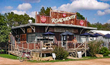
| Bastrop | 30.110495, -97.31527 |
| Bastrop City Hall | 30.110197, -97.311798 |
| Bastrop Commons Park | 30.106606, -97.32277 |
| Bastrop County Courthouse | 30.109661, -97.318881 |
| Bastrop County Historical Museum | 30.011888, -97.157488 |
| Bastrop Erhard Field | 30.117161, -97.310548 |
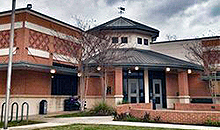
| Bastrop Public Library | 1100 Church St, Bastrop |
| Bastrop State Park | 30.112439, -97.260824 |
| Bateman | 29.951332, -97.475273 |
| Buescher State Park | 30.059386, -97.170544 |
| Butler | 30.320766, -97.29666 |
| Caldwell Knob | 30.152437, -97.469163 |
| Camp Swift | 30.227935, -97.291515 |
| Camp Swift | 30.19077, -97.292214 |
| Cedar Creek | 30.087161, -97.50083 |
| Circle D Estates | 30.159631, -97.232882 |
| City Park | 30.109662, -97.293881 |
| Clearview | 30.042719, -97.335548 |
| Colorado | 29.985777, -97.134154 |
| Colorado River Bridge | 30.105217, -97.323048 |
| Crafts Prairie | 30.043553, -97.257213 |
| Crocheron-McDowall House | 30.11605, -97.322493 |
| David Bottom | 30.028831, -97.268602 |
| Elgin | 30.349653, -97.370274 |
| Elgin City Hall | 30.350297, -97.371879 |
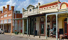
| Elgin Commercial Historic District | 30.350764, -97.368051 |
| Elgin Public Library | 27.541427, -97.373325 |
| Elysium | 30.166881, -97.515276 |
| Firemans Park | 30.105495, -97.313603 |
| Flag Hill | 29.910501, -97.416383 |
| Flower Hill | 29.965223, -97.131654 |
| Garwood Ranch | 30.263823, -97.327494 |
| Goebel Store | 30.014665, -97.058596 |
| Grassyville | 30.140773, -97.071375 |
| Hardeman Bend | 30.047997, -97.201933 |
| Hemphill Bend | 30.178548, -97.390273 |
| Hemphill Prairie | 30.156604, -97.389161 |
| High Point | 29.963, -97.330548 |
| Hills Prairie | 30.051608, -97.291936 |
| Hills Prairie | 30.051608, -97.291936 |
| Humble Camp | 30.011053, -97.403049 |
| Jeddo | 29.808838, -97.314713 |
| Jordan | 29.940778, -97.354715 |
| KC Estates | 30.148653, -97.241498 |
| Kennedy Bluffs | 30.053553, -97.203322 |
| Kovar | 29.901891, -97.213878 |
| Lake Bastrop - North Shores Park | 30.169104, -97.279158 |
| Lake Bastrop - South Shores Park | 30.141605, -97.286103 |
| Lower Cedar Hollow | 30.01396, -97.448184 |
| McDade | 30.283823, -97.237769 |
| McDade Historical Museum | Unknown |
| Mount Pleasant (historical) | Unknown |
| Paige | 30.210215, -97.114987 |
| Pea Ridge | 29.948278, -97.218045 |
| Phelan | 30.158826, -97.326104 |
| Pigeonroost Hollow | 30.062103, -97.241575 |
| Pin Oak | 30.085496, -97.085264 |
| Pine Hills | 30.138471, -97.253255 |
| Pleasant Grove (historical) | 30.382985, -97.31555 |
| Pope Bend | 30.185214, -97.42944 |
| Powell Bend | 30.156049, -97.353605 |
| Poyston School | 30.056885, -97.30527 |
| Red Bluffs | 30.073829, -97.278047 |
| Red Rock | 29.959666, -97.446106 |
| Reed Bend | 30.148827, -97.36805 |
| Rockne | 29.995776, -97.431106 |
| Rockne Museum | Unknown |
| Rosanky | 29.92939, -97.293602 |
| Royston Hill | 29.985222, -97.227212 |
| Salem | 29.843004, -97.327769 |
| Sayersville | 30.23188, -97.327216 |
| Shiloh (historical) | 30.091884, -97.383327 |
| Smithville | 30.008554, -97.159432 |
| Smithville City Hall | 30.009188, -97.159552 |
| Smithville Commercial Historic District | 30.00911, -97.161099 |
| Smithville Heritage Society Museum | Unknown |
| Smithville Public Library | 27.66309, -97.158877 |
| Smithville Railroad Historical Park & Museum | 30.041331, -97.138321 |
| Smithville Residential Historic District | 30.009388, -97.156654 |
| String Prairie | 29.88578, -97.346937 |
| Swiftex | 30.206325, -97.313604 |
| Togo | 29.950501, -97.219156 |
| Upper Cedar Hollow | 29.99522, -97.471384 |
| Upton | 30.011332, -97.264157 |
| Utley | 30.181881, -97.420829 |
| Watterson | 29.989109, -97.387771 |
| Wilbargers Bend | 30.149659, -97.444718 |
| Willman | 29.933001, -97.260268 |
| Wyldwood | 30.129382, -97.472774 |