
Main Menu
Brazoria County Data
Brazoria County Communities & Places
Genealogy & History Links by USGHN
Important Brazoria County Addresses
Sponsors
Brazoria County Neighbors
Fort Bend County, Texas
Galveston County, Texas
Harris County, Texas
Matagorda County, Texas
Wharton County, Texas
Other Websites
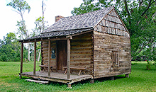
Brazoria County, Texas Communities & Places
| |||
Please submit your Brazoria County, Texas communities and places for researchers to share. Send your information to the Brazoria County, Texas Genealogy & History Network at: txghn@outlook.com
|

NAME |
LOCATION |
| Abercrombie | 29.032196, -95.753285 |
| Alexander Landing | 29.5623, -95.268 |
| Alligator Point | 29.171907, -95.113262 |
| Alvin | 29.423847, -95.244101 |
| Alvin Branch Library | 29.090521, -95.244656 |
| Alvin City Hall | 29.424143, -95.245378 |
| Alvin Museum | 29.397181, -95.239378 |
| Ammon Underwood House | 29.139136, -95.617724 |
| Amsterdam | Unknown |
| Anchor | 29.208299, -95.473275 |
| Angleton | 29.16941, -95.431885 |
| Angleton City Hall | 29.16378, -95.431005 |
| Angleton Library | 29.131077, -95.42744 |
| Arcadia Reef | 29.029411, -95.204933 |
| Arrington Park | 28.951915, -95.370218 |
| Austin Park | 28.977747, -95.367995 |
| Bailey Prairie | 29.151911, -95.508832 |
| Banbury Cross | 29.5641, -95.2632 |
| Bar-X | Unknown |
| Bastrop Beach | 29.111911, -95.372438 |
| Big Bend | 28.937748, -95.32605 |
| Bird Island | 29.095521, -95.141041 |
| Bonney | 29.316629, -95.447996 |
| Brazoria | 29.044415, -95.569113 |
| Brazoria Bridge | 29.054414, -95.557168 |
| Brazoria City Hall | 29.044314, -95.568797 |
| Brazoria City Park | 29.044692, -95.561612 |
| Brazoria Community Library | 29.138579, -95.569667 |
| Brazoria County Courthouse | 29.167743, -95.431885 |
| Brazoria County Historical Museum | 29.16941, -95.431885 |
| Brazoria County Library System | 29.143577, -95.431607 |
| Brazos Heritage Museum | 29.021635, -95.333827 |
| Brazosport | 28.947192, -95.314382 |
| Brazosport Museum of Natural Science | 29.041357, -95.412996 |
| Brookside Village | 29.5869, -95.325215 |
| Bryan Beach | 28.898583, -95.350773 |
| Bryan Beach | 28.883306, -95.378552 |
| Bryan Mound | 28.915527, -95.377441 |
| Buffalo Camp | Unknown |
| Camp Mohawk | 29.337461, -95.290769 |
| Cannon Gully | 29.140972, -95.719331 |
| Cedar Bar (historical) | Unknown |
| Chenango | 29.254131, -95.45883 |
| Chenango Plantation | 29.258575, -95.478552 |
| China Grove | 29.312741, -95.456608 |
| Chocolate Bayou | 29.315238, -95.253822 |
| Chocolate Springs | 29.304683, -95.262156 |
| Christmas Point | 29.079132, -95.174098 |
| Christmas Point Reef | 29.082743, -95.169653 |
| Churchill | 28.934696, -95.55717 |
| Clute | 29.024691, -95.398829 |
| Clute Branch Library | 29.168576, -95.402995 |
| Clute City Hall | 29.02193, -95.403956 |
| Clute City Park | 29.023858, -95.409941 |
| Cobblestone | 29.5436, -95.2914 |
| Columbia Historical Museum Association | 29.143303, -95.639669 |
| Columbia Lakes | Unknown |
| Cone Island | 28.975524, -95.295492 |
| Country Place | 29.5797, -95.3644 |
| Crews Park | 29.01108, -95.43522 |
| Damon | 29.290523, -95.734671 |
| Damon Mound | 29.291357, -95.74606 |
| Danbury | 29.228297, -95.344937 |
| Danciger | 29.171638, -95.818841 |
| Demi-John Island | Unknown |
| Dixie Hollow | 29.5547, -95.2289 |
| Drum Point | 28.99469, -95.238545 |
| Dunbar Park | 29.054691, -95.462165 |
| Durazno Plantation | 28.960526, -95.447443 |
| Eagle Gully | 29.190797, -95.311324 |
| East Columbia | 29.141358, -95.61578 |
| East Columbia Historic District | 29.142747, -95.615224 |
| El Bernardo | 29.04025, -95.652726 |
| Ellerslie Plantation | 28.974138, -95.501611 |
| English | 29.374129, -95.527721 |
| Ernies Acres | Unknown |
| Fairway Village | 29.538, -95.3635 |
| Follets Island | 29.042466, -95.169654 |
| Four Corners | 29.000806, -95.644115 |
| Four Corners | 29.001917, -95.645504 |
| Freeport | 28.954137, -95.359662 |
| Freeport Branch Library | 29.169965, -95.373827 |
| Freeport City Hall | 28.951104, -95.347673 |
| Garden Acres | 29.562, -95.3167 |
| Garland Park | 29.016913, -95.424663 |
| Gayle Estates | Unknown |
| Genther Station | 29.253298, -95.518276 |
| Grassy Point | 29.203296, -95.172708 |
| Gulf Park | 28.961082, -95.41383 |
| Gulf Prairie (historical) | Unknown |
| Halls Bayou Camp | 29.285516, -95.130207 |
| Harborview | Unknown |
| Hasima | 29.028308, -95.774397 |
| Hastings | 29.508846, -95.251602 |
| Hastings Siding | 29.477458, -95.261602 |
| Hawkinsville (historical) | Unknown |
| Heritage Green | 29.5661, -95.2693 |
| Hickory Creek Place | 29.5705, -95.3177 |
| Hide Away | Unknown |
| Hillcrest | 29.392737, -95.259379 |
| Hinkles Ferry | 28.96775, -95.566058 |
| Hinkles Ferry | 28.949695, -95.557447 |
| Holiday Lake Municipal Building | 29.204435, -95.517058 |
| Holiday Lakes | 29.209688, -95.516887 |
| Holiday Shores | Unknown |
| Horse Grove Point | 29.19524, -95.15743 |
| Horseshoe Bend | 29.217462, -95.214098 |
| Hoskins | 29.009691, -95.384384 |
| Hoskins | 29.134131, -95.234378 |
| Hoskins Mound | 29.138853, -95.227711 |
| Independence Park | 29.542456, -95.266047 |
| Iowa Colony | 29.482459, -95.415496 |
| Iowa Colony City Hall | 29.410027, -95.410123 |
| John McCroskey Cabin | 28.939696, -95.615227 |
| Jones Creek | 28.968582, -95.455221 |
| Lake Barbara | 29.025246, -95.389384 |
| Lake Jackson | 29.033858, -95.434386 |
| Lake Jackson Branch Library | 29.201076, -95.446885 |
| Lake Jackson City Hall | 29.037976, -95.44903 |
| Lake Jackson Farms | 29.057746, -95.471609 |
| Lakepointe | 29.5425, -95.3566 |
| Lakes of Country Place | 29.5798, -95.3715 |
| Las Playas | Unknown |
| Le Tufle Park | 28.983313, -96.014681 |
| Linwood | 29.5686, -95.2742 |
| Liverpool | 29.294961, -95.278823 |
| Lochridge | 29.353018, -95.531055 |
| Mac Lean Park | 29.027747, -95.458554 |
| Magnolia Place | 29.5488, -95.2922 |
| Manvel | 29.462737, -95.357994 |
| Manvel Branch Library | Unknown |
| Manvel City Hall | 29.468052, -95.357553 |
| McLean Road Park | 29.551067, -95.295492 |
| McNeel | Unknown |
| Meadowview | 29.5494, -95.3637 |
| Midway | 28.954137, -95.336883 |
| Mims | 29.087188, -95.287158 |
| Moodys Island | 29.073299, -95.149653 |
| Morgan Park | 29.409959, -95.258546 |
| Mud Island | 29.088021, -95.15243 |
| Mud Pit | 28.913305, -95.369385 |
| New Bayou Point | 29.19024, -95.137707 |
| Newman Park | 29.432458, -95.260213 |
| Oak Bend | Unknown |
| Oakbrook Estates | 29.5398, -95.2551 |
| Oakland | 28.991914, -95.443831 |
| Old Brazoria | 29.055526, -95.565224 |
| Old Brazoria County Courthouse | 29.169132, -95.431329 |
| Old Ocean | 29.079973, -95.749673 |
| Orozimbo | 29.253577, -95.577166 |
| Otey | 29.285798, -95.545499 |
| Oyster Creek | 29.003024, -95.331882 |
| Parkview | 29.5489, -95.2611 |
| Pearland | 29.563567, -95.286047 |
| Pearland Branch Library | 29.269684, -95.256044 |
| Pearland City Hall | 29.549832, -95.256972 |
| Pearland Library | 29.5497, -95.2573 |
| Perry Landing | 28.979971, -95.489389 |
| Perrys Landing (historical) | Unknown |
| Peterson Landing | 29.243295, -95.229377 |
| Pineshadows | 29.5577, -95.2382 |
| Port Morris | 29.096632, -95.203821 |
| Port-Au-Prince | Unknown |
| Quintana | 28.933304, -95.308271 |
| Quintana Beach | 28.923304, -95.316605 |
| Quintana Town Office | 28.934233, -95.309179 |
| Rattlesnake Mound | 29.204962, -95.111039 |
| Rattlesnake Point | 29.029967, -95.217989 |
| Ravenwood Estates | 29.5318, -95.319 |
| Regal Oaks | 29.552, -95.2499 |
| Regency Park | 29.5625, -95.2742 |
| Retrieve | 29.108856, -95.491054 |
| Retrieve State Farm | 29.09219, -95.481054 |
| Richwood | 29.056079, -95.40994 |
| Richwood City Hall | 29.055819, -95.411783 |
| Rivers End | Unknown |
| Riverside Park | 28.969137, -95.372718 |
| Rosharon | 29.352184, -95.460219 |
| Ross | 29.051079, -95.42133 |
| Rueben Welch Park | 29.156632, -95.403273 |
| Rustic Oaks | 29.541, -95.2449 |
| Ryan Acres | 29.5456, -95.2978 |
| San Luis (historical) | Unknown |
| San Luis Island | 29.074965, -95.127985 |
| Sandy Point | 29.385517, -95.481053 |
| Sedgewood | 29.5315, -95.3554 |
| Shadycrest | 29.5462, -95.2548 |
| Shell Point | 29.196074, -95.14993 |
| Sherwood | 29.5571, -95.2722 |
| Sleepy Hollow | 29.5557, -95.2326 |
| Slough Ridge | 29.016634, -95.305214 |
| Snipe | 29.123578, -95.482165 |
| Snug Harbor | Unknown |
| Southdown | Unknown |
| Southdown | 29.5732, -95.3666 |
| Southwyck | 29.5383, -95.3528 |
| Stratton Ridge | 29.049412, -95.337715 |
| Sugar Mill | Unknown |
| Suggs Park | 29.050246, -95.423274 |
| Surfside | 28.943303, -95.297715 |
| Surfside Beach | 28.944414, -95.288826 |
| Surfside Beach City Hall | 28.942849, -95.299683 |
| Sweeney City Hall | 29.045276, -95.711336 |
| Sweeny | 29.038862, -95.698561 |
| Sweeny Community Library | 29.2908, -95.713559 |
| Turner | 29.5703, -95.2811 |
| Turtle Cove | Unknown |
| Van Pelt | 29.133577, -95.431052 |
| Varner Hogg Plantation State Historical Park | 29.163024, -95.639669 |
| Velasco | 28.961914, -95.360495 |
| Velasco Heights | 28.983025, -95.371051 |
| Village of Bonney City Hall | 29.315475, -95.449641 |
| Waterbury | 29.5478, -95.3805 |
| West Columbia | 29.143858, -95.645225 |
| West Columbia Branch Library | 29.301355, -95.642168 |
| West Columbia City Hall | 29.144566, -95.641867 |
| West Lea | 29.5366, -95.3255 |
| West Oaks | 29.5562, -95.3159 |
| West Oaks Village | 29.5495, -95.3211 |
| Westchester Estates | 29.5559, -95.3339 |
| Westminster | 29.5778, -95.2925 |
| Westwood Village | 29.5363, -95.2942 |
| Wild Peach | 29.068304, -95.621614 |
| Wild Peach Village | 29.083582, -95.633836 |
| Woodcreek | 29.5532, -95.2342 |