
Main Menu
Scurry County Data
Scurry County Communities & Places
Genealogy & History Links by USGHN
Important Scurry County Addresses
Sponsors
Scurry County Neighbors
Borden County, Texas
Fisher County, Texas Genealogy & History Network
Garza County, Texas
Howard County, Texas
Kent County, Texas
Mitchell County, Texas
Other Websites
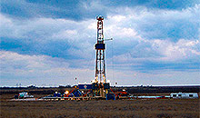
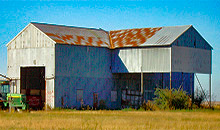
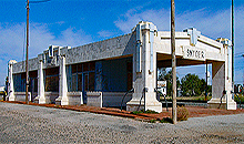
Scurry County, Texas Communities & Places
| |||
Please submit your Scurry County, Texas communities and places for researchers to share. Send your information to the Scurry County, Texas Genealogy & History Network at: txghn@outlook.com
|
NAME |
LOCATION |
| Arah | 32.758056, -101.135000 |
| Brand | 32.792222, -100.960556 |
| Camp Springs | 32.759722, -100.691944 |
| Cedar Draw | 32.868889, -100.788333 |
| China Grove | 32.530000, -100.817222 |
| Church Peak | 32.920278, -100.764444 |
| Cottonwood Flat | 32.896111, -100.721389 |
| Cox Hollow | 32.972778, -100.691944 |
| Dermott | 32.854444, -101.015556 |
| Dunn | 32.566944, -100.885278 |
| Fault Draw | 32.841389, -100.752500 |
| Flat Top Mountain | 32.966111, -101.065000 |
| Fluvanna | 32.885556, -101.148611 |
| Franklin Center | 32.729722, -101.031389 |
| Fuller Brothers L P Ranch | 32.932778, -101.055556 |
| Fuller Ranch | 32.905000, -100.876389 |
| Fullerville | 32.925278, -101.065278 |
| Green Mountain | 32.823056, -100.693889 |
| Gyp Draw | 32.850278, -100.698889 |
| Hathaway Hill | 32.794722, -101.152500 |
| Hell Roaring Hollow | 32.652500, -100.892778 |
| Hermleigh | 32.635000, -100.759167 |
| Horse Hollow | 32.853611, -100.679444 |
| Hudd | 32.926389, -100.679722 |
| Impossible Canyon | 32.955556, -100.728056 |
| Inadale | 32.540833, -100.683056 |
| Ira | 32.581944, -101.001944 |
| Knapp | 32.648333, -101.117500 |
| Lloyd Mountain | 32.811667, -100.802222 |
| Longhorn Valley | 32.955833, -100.609722 |
| Midway | 32.732778, -100.682778 |
| Mooar Draw | 32.765278, -101.115000 |
| North East Park | 32.730278, -100.912222 |
| Overlook Hill | 32.879167, -100.752500 |
| Pyron Siding | 32.581944, -100.668333 |
| Red Aleck Canyon | 32.957222, -100.728056 |
| Scurry County Museum | 32.742222, -100.918611 |
| Snyder | 32.717778, -100.917500 |
| South Cox Hollow | 32.931111, -100.790556 |
| Union | 32.728889, -100.997500 |
| Wildcat Draw | 32.576389, -100.874722 |
| Winston Park | 32.703333, -100.910278 |