
Main Menu
Anderson County Data
Anderson County Communities & Places
Genealogy & History Links by USGHN
Important Anderson County Addresses
Sponsors
Anderson County Neighbors
Cherokee County, Texas
Freestone County, Texas
Henderson County, Texas
Houston County, Texas
Leon County, Texas
Navarro County, Texas
Other Websites
Anderson County, Texas Communities & Places
| |||
Please submit your Anderson County, Texas communities and places for researchers to share. Send your information to the Anderson County, Texas Genealogy & History Network at: txghn@outlook.com
|
NAME |
LOCATION |
| Alderbranch | 31.688889, -95.458056 |
| Allen Bluff | 31.958889, -96.029722 |
| Anderson Bluff | 32.058056, -95.443056 |
| Anderson County Jail (historical) | 31.764444, -95.626944 |
| Beaver | Unknown |
| Bethel | 31.920278, -95.920278 |
| Blackfoot | 31.946389, -95.835278 |
| Bois d'Arc | 31.958611, -95.753056 |
| Bradford | 31.988889, -95.766667 |
| Broom City | Unknown |
| Brushy Creek | 31.957778, -95.615000 |
| Calhoun | 31.738611, -95.585556 |
| Calhoun Streen Park | 31.768333, -95.615556 |
| Camp Hill | 31.693333, -95.537500 |
| Cayuga | 31.957222, -95.974722 |
| Cox Bluff | 31.928611, -96.009167 |
| Cronin | 31.676389, -95.616667 |
| Crystal Lake | 31.739722, -95.505278 |
| Daly Mountain | 31.873611, -95.496944 |
| Davey Dogwood Park | 31.788056, -95.640556 |
| Deanwright | 31.736667, -95.542778 |
| Denmark (historical) | Unknown |
| Elkhart | 31.628056, -95.578889 |
| Elkhart Post Office | 31.626111, -95.580000 |
| Elmtown | 31.896111, -95.628611 |
| Elmwood | 31.919722, -95.631111 |
| Fastrill Bridge | 31.630000, -95.285278 |
| Flint Hill | 31.845278, -95.467222 |
| Fort Houston (historical) | Unknown |
| Fosterville | 32.010833, -95.614722 |
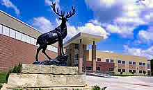
| Frankston | 32.056111, -95.504444 |
| Frankston Post Office | 32.050278, -95.502500 |
| Gatewood-Shelton Gin | 31.764722, -95.629722 |
| Green Park | 31.776389, -95.638611 |
| Greens Bluff | 31.870278, -95.969444 |
| Harmony | 31.758333, -95.793889 |
| Herring | 31.759167, -95.401111 |
| Houston Mound Historical Marker | 31.576944, -95.410278 |
| Howard House Museum | 31.770000, -95.625833 |
| Jarvis | 31.755278, -95.445000 |
| John H. Reagan Monument | 31.758333, -95.625000 |
| Kathleen C. Fitzgerald Museum | 32.051667, -95.506667 |
| Kickapoo Battlefield Monument | 32.024167, -95.488889 |
| Kickapoo Mountain | 32.033056, -95.480833 |
| Kossuth | 31.742500, -95.498889 |
| Lakeview Assembly | 31.658611, -95.686111 |
| Lindsey Bluff | 31.955556, -96.019444 |
| Link House | 31.763611, -95.638611 |
| Long Lake | 31.649722, -95.781111 |
| Massey Lake | 31.812222, -95.868333 |
| McClures (historical) | Unknown |
| McDonald Museum | 31.873056, -95.503333 |
| Montalba | 31.876667, -95.732778 |
| Mound City | 31.576944, -95.406389 |
| Mound Prairie | 31.870000, -95.568333 |
| Museum for East Texas Culture | 31.757778, -95.627500 |
| Neches | 31.866944, -95.495833 |
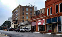
| North Side Historic District | 31.769722, -95.637778 |
| Palestine | 31.762222, -95.630833 |
| Pert | 31.922500, -95.547222 |
| Pilgrim (historical) | Unknown |
| Pine Mountain | 31.954167, -95.694722 |
| Reagan Park | 31.758611, -95.626389 |
| Redlands Hotel | 31.763056, -95.634167 |
| Redtown | Unknown |
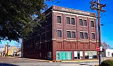
| Robinson Bank Building | 31.762500, -95.633056 |
| Rocky Point | 31.840833, -95.443056 |
| Salmon | 31.573056, -95.498333 |
| Sand Hollow | 31.770278, -95.732778 |
| Slocum | 31.631389, -95.462222 |
| South Side Historic District | 31.760833, -95.637222 |
| Springfield | 31.986944, -95.805278 |
| Strong Memorial Park | 31.624722, -95.480278 |
| Tennessee Colony | 31.835556, -95.838889 |
| Texas State Railroad State Historical Park | 31.740278, -95.577778 |
| Todd City | 31.919167, -95.477778 |
| Tucker | 31.673611, -95.748056 |
| Ward | 31.907222, -95.804722 |
| Wells Creek | 31.798333, -95.555278 |
| William & Caroline Broyles House | 31.749167, -95.628611 |
| Yard | 31.865278, -95.966944 |