
Main Menu
Gonzales County Data
Gonzales County Communities & Places
Genealogy & History Links by USGHN
Important Gonzales County Addresses
Sponsors
Gonzales County Neighbors
Bastrop County, Texas Genealogy & History Network
Caldwell County, Texas Genealogy & History Network
Dewitt County, Texas
Fayette, New Mexico
Guadalupe County, Texas
Karnes County, Texas
Lavaca County, Texas
Wilson County, Texas
Other Websites
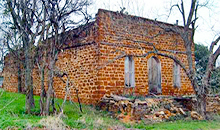
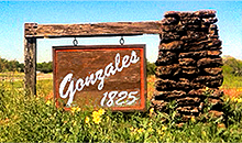
Gonzales County, Texas Communities & Places
| |||
Please submit your Gonzales County, Texas communities and places for researchers to share. Send your information to the Gonzales County, Texas Genealogy & History Network at: txghn@outlook.com
|
NAME |
LOCATION |
| Abercrombie Ranch | 29.460239, -97.368602 |
| Bald Mound | 29.176913, -97.65444 |
| Bebe | 29.415238, -97.637219 |
| Belmont | 29.523289, -97.683887 |
| Braches House | 29.476072, -97.309156 |
| Brown Hill | 29.769117, -97.314991 |
| Chalk Hollow | 29.709368, -97.402456 |
| Cheapside | 29.278301, -97.403046 |
| Comanche Crossing | 29.573569, -97.2711 |
| Cost | 29.437461, -97.528883 |
| Dewville | 29.378016, -97.811112 |
| Dilworth | 29.508016, -97.285267 |
| Dilworth Spr | 29.566621, -97.669998 |
| Dreyer | 29.367188, -97.273044 |
| DuBose Ranch Headquarters | 29.230802, -97.487769 |
| Eggleston House | 29.500793, -97.443048 |
| Evans Hollow | 29.29802, -97.640829 |
| Glaze City | 29.407186, -97.2886 |
| Gonzales | 29.501626, -97.452493 |
| Gonzales City Park | 29.50607, -97.437492 |
| Gonzales Commercial Historic District | 29.503292, -97.457215 |
| Gonzales County Courthouse | Unknown |
| Gonzales County Jail (historical) | 29.501348, -97.451937 |
| Gonzales Memorial Museum | 29.500793, -97.443048 |
| Gonzales Memorial Park | 29.510237, -97.42027 |
| Gonzales Municipal Building | 29.505211, -97.453965 |
| Gonzales Public Library | Unknown |
| Hamon | 29.395797, -97.366935 |
| Hamon | 29.405241, -97.349157 |
| Harwood | 29.665786, -97.505272 |
| Hickston | 29.603013, -97.27499 |
| Howell Hollow | 29.252468, -97.447213 |
| Independence Park | 29.487737, -97.454993 |
| Kennard House | 29.50607, -97.469715 |
| Kokernot | 29.443018, -97.266656 |
| Leesville | 29.406904, -97.744999 |
| Little New York | 29.55107, -97.306657 |
| Long Hollow | 29.673142, -97.437742 |
| Long Hollow | 29.29302, -97.637495 |
| Monthalia | 29.468848, -97.608607 |
| Newtonville | 29.652178, -97.194988 |
| Nickel | 29.555515, -97.218877 |
| Nickel (historical) | Unknown |
| Nixon | 29.267464, -97.764443 |
| Nixon City Hall | 29.26946, -97.765377 |
| Nixon Public Library | 31.764045, -97.765581 |
| Oak Forest | 29.498847, -97.584718 |
| Ottine | 29.59801, -97.584163 |
| Palmetto State Park | 29.587177, -97.582218 |
| Pettit Prairie Flats | 29.576625, -97.275823 |
| Pilgrim | 29.293299, -97.521937 |
| Pin Oak Mound | 29.567736, -97.256656 |
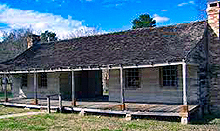
| Pioneer Village | 29.483571, -97.43027 |
| Quien Sabe Ranch | 29.436347, -97.782222 |
| Red Hill | 29.618565, -97.575274 |
| Rocky Mound | 29.191913, -97.630273 |
| Russell Hill | 29.636623, -97.156654 |
| Saint James | 29.567178, -97.604719 |
| Sample | 29.218858, -97.523325 |
| Sandy Fork | 29.684953, -97.417215 |
| Santa Anna Mound | 29.478293, -97.450826 |
| Saturn | 29.598845, -97.343602 |
| Saturn | 29.602456, -97.338602 |
| Schoolland | 29.333852, -97.664441 |
| Sedan (historical) | Unknown |
| Slayden | 29.575511, -97.533884 |
| Smiley | 29.267743, -97.635828 |
| Smithville | 29.524123, -97.608052 |
| Stella Ellis Hart Public Library | Unknown |
| Stevens Hill | 29.451071, -97.551939 |
| Summerville | 29.455238, -97.470548 |
| Thompsonville | 29.70273, -97.381937 |
| Turkey Bottom | 29.374966, -97.254989 |
| Van Cleave Mound | 29.189969, -97.619717 |
| Waelder | 29.693287, -97.299157 |
| Waelder Municipal Building | 29.694218, -97.300844 |
| Watson Hill | 29.476069, -97.615552 |
| Wells Ranch | 29.451347, -97.759444 |
| Windy Hill | 29.255801, -97.51138 |
| Wolf Hollow | 29.237189, -97.586938 |
| Wrightsboro | 29.373852, -97.564994 |
| Yokum | 29.161081, -97.563327 |