Main Menu
Hardeman County Data
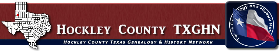
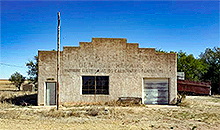
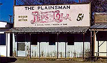
Hockley County Communities & Places
Genealogy & History Links by USGHN
Important Hockley County Addresses
Sponsors
Hockley County Neighbors
Bailey County, Texas Genealogy & History Network
Cochran County, Texas
Hale County, Texas
Lamb County, Texas
Lubbock County, Texas
Lynn County, Texas
Terry County, Texas
Yoakum County, Texas
Other Websites
Welcome to Hockley County Texas Genealogy & History Network!
Welcome to the Hockley County, Texas Genealogy & History Network. Our purpose is to provide visitors with free resources for genealogical and historical research. To share your genealogy or history information, send an email to txghn@outlook.com and we will happily include it here. For other Texas Counties, visit the Texas Genealogy & History Network state website and go to the appropriate county. Thanks for visiting and good luck with your research! |
|
About Hockley County, Texas...
Hockley County is in northwestern Texas, south of the Panhandle. The center of the county lies approximately thirty miles west of Lubbock. The county, named for George W. Hockley, is comprised of generally flat land that drains to numerous playas, the Yellow House River, and Yellow House Lake.
Yellow House Canyon cuts into the northern part of the county and is mostly grass-covered, although sand hills and gravel deposits occur. The canyon, once a tributary of the Brazos River, is one of the most salient landmarks on the South Plains. It takes its name from high, yellow bluffs near its head.
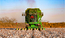
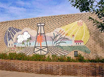
The county's economy includes significant revenue from agriculture, 70 percent of which comes from crops that include cotton, sorghums, wheat, soybeans, corn, hay, and sunflowers. The rest comes from cattle, hogs, and sheep. Irrigated land totals about 200,000 acres.
In 1982 oil production in Hockley County totaled more than 39,000,000 barrels. Petroleum processing, the manufacture of oilfield equipment, processing of vegetable oil, and cattle feeding are industries complementing the area's large oil production.
In prehistoric times Folsom man hunted in the area. Spanish explorers ventured into or near Hockley County during the sixteenth century, and in the early eighteenth century the Comanches displaced the 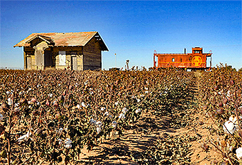 Apaches in the region. Much of the history of the area revolves around Yellow House Canyon. The Comanches, hunting buffalo and attacking enemies, watered at the springs in the canyon for decades before white men took an interest in the region.
The canyon lay along a north-south trail between New Mexico and Mexico. In 1879 a squad of Texas Rangers found Yellow House Canyon during a fierce blizzard. Without the help given them by John and Thomas L. Causey, who were hunting buffalo in the area, the soldiers might have starved. In 1881 the canyon lay on a mail route from Colorado City to Fort Sumner, New Mexico. By this time the Indians had been removed by the United States Army.
In 1876 the Texas legislature formed Hockley County from lands formerly assigned to Bexar and Young counties. Because settlers were slow to move into the area, however, the county was assigned to Lubbock County for administrative purposes until 1920. Until the early twentieth century, the area was dominated by a few large cattle operations. The Causeys were the first settlers in the area. After several years of buffalo hunting in Kansas and Texas, they established a base at Yellow House Canyon in 1877 and built the first house in the county. When the buffalo herds were depleted, the Causeys went into the bone business, and in 1882 they established a ranch. In 1885, however, the XIT Ranch, one of the state's largest cattle-raising ventures, was founded in the area, and the Causeys were forced to move.
The XIT expanded to include the northern third of Hockley County. Meanwhile, other sections of county land were bought by such ranchers as F. G. Oxsheer, David M. Devitt, John Gordon, and Dudley H. and John W. Snyder. Virtually all of Hockley County was owned by these few men by the 1890s. In 1900 five ranches, encompassing almost 354,000 acres, were reported in the county; about 15,700 cattle were counted in the area that year. No crops were reported.
 The first settlers interested in small-scale ranching or farming were homesteaders who established themselves on properties within a strip of land overlooked in the county's first survey (and consequently not included within the huge ranches). This strip, varying in width from three-fourths of a mile to two miles, extended the entire length of the county's southern border. Jim Jarrott encouraged settlement there between 1901 and 1903. The Yellow House section of the XIT, consisting of 235,858 acres in Hockley County and three adjacent counties, was sold to George W. Littlefield in 1901.
In 1912, Littlefield began selling farm acreage. Despite this limited burst of settlement in the county, diversified economic development and more significant population growth were delayed until the 1920s, when the big ranchers began selling lands for agricultural uses. As late as 1920 only 3,235 acres was classified as improved. Nevertheless, by this time county residents wanted their own county government. The county was organized in 1921; Hockley City won over Ropesville in the county-seat contest.
The settlement of the county accelerated during the 1920s. Hockley City, where the Littlefield Lands Company sold 464 farm tracts between 1912 and 1920, was renamed Levelland in 1922; the Slaughter heirs began selling farmland in the northwestern part of the country near Whiteface in 1924. Thousands of settlers moved into the county to establish new farms during this period. Most of the newcomers grew cotton. Only eighty-seven acres in the county had been planted in cotton in 1920, but by 1929 cotton culture occupied more than 95,000 acres of county land. Corn culture also expanded quickly during this period, so that by 1929 about 8,300 acres in the county was planted in that staple. In all, cultivated land in the county totaled almost 175,000 acres by 1929.
 The Great Depression of the 1930s produced difficult times in Hockley County. Virtually all of the land previously sold to prospective farmers by the Slaughter heirs, for example, was repossessed in 1930 and 1931. Nevertheless, the number of farms in the county grew significantly during this period as the cotton boom continued and more land was put into cultivation. By 1939, 1,506 farms had been established in Hockley County. More than 106,000 acres was planted in cotton that year, and almost another 150,000 in sorghum; cultivated land totaled more than 266,000 acres.
The economy also received a boost in 1937, when oil was discovered in the county. A total of almost 68,000 barrels of crude was pumped from county lands in 1938. The economy grew even more rapidly in the 1940s with the expansion of irrigation and the substantial production of oil at Sundown and other fields. The county pumped more than 14,287,000 barrels of crude in 1944 and more than 20,818,000 in 1948; by 1950 there were 3,000 producing oil wells in Hockley County.
In the 1980s the county's agricultural economy continued to be focused on cotton production; about 47 percent of Hockley County's farmland was irrigated. Oil also remained an important part of the economy, though production had been declining since the 1970s, when it hovered around 50,000,000 barrels a year. Production totaled more than 39,120,000 barrels in 1982 and about 28,968,000 in 1990. By January 1991 more than 1,280,032,600 barrels of oil had been taken from Hockley County since discovery in 1937.
The county has a total area of 909 square miles, of which 908.8 square miles is land and 0.2 square miles 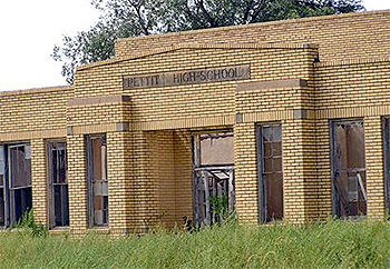 (0.02%) is water. The population recorded in the 1900 Federal Census was 44. The population peaked in 1990 at 24,199. The 2010 census recorded 22,935 residents there.
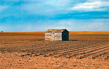
Neighboring counties are Lamb County (north), Lubbock County (east), Terry County (south), Cochran County (west), Yoakum County (southwest), Bailey County (northwest), Hale County (northeast), and Lynn County (southeast). The county seat is Levelland. Other communities in the county include Anton, Opdyke West, Oklahoma Flat, Pep, Pettit, Roundup, Ropesville, Smyer, Sundown, and Whitharral.
Hockley County, Texas Records
Birth Records - The Texas Department of State Health Services has records from 1903 to present. Records for the last 75 years considered private and will only be provided to certain individuals. To obtain current information on who may obtain a record, how to submit a request and an official request form, see the Texas Department of State Health Services website or write to Texas Vital Records, Department of State Health Services, P.O. Box 12040, Austin, TX 78711-2040.
For older birth records you will have to write to the County Clerk of the applicable county. The existence of birth records prior to 1903 will vary widely from county to county. Local historical societies and genealogy collections in local libraries may be able to provide some information.
Death Records - The Texas Department of State Health Services has records from 1903 to present. Records for the last 25 years considered private and will only be provided to certain individuals. To obtain current information on who may obtain a record, how to submit a request and an official request form, see the Texas Department of State Health Services website or write to Texas Vital Records, Department of State Health Services, P.O. Box 12040, Austin, TX 78711-2040.
Marriage Records - The Texas Department of State Health Services can provide a verification letter of marriage for Texas marriages from 1966 to present. This is NOT a marriage license. To obtain a certified copy of a marriage license you must contact the County or District Clerk in the county or district where the marriage took place.
Local historical societies and genealogy collections in local libraries may be able to provide some information.
Divorce Records - The Texas Department of State Health Services can provide a verification letter of divorce for Texas divorces from 1968 to present. This is NOT a copy of the divorce decree. To obtain a certified copy of a copy of the divorce decree you must contact the County or District Clerk in the county or district where the divorce took place.
Local historical societies and genealogy collections in local libraries may be able to provide some information.