
Main Menu
Brazoria County Data
Brazoria County Communities & Places
Genealogy & History Links by USGHN
Important Brazoria County Addresses
Sponsors
Brazoria County Neighbors
Fort Bend County, Texas
Galveston County, Texas
Harris County, Texas
Matagorda County, Texas
Wharton County, Texas
Other Websites
Welcome to Brazoria County Texas Genealogy & History Network!
Welcome to the Brazoria County, Texas Genealogy & History Network. Our purpose is to provide visitors with free resources for genealogical and historical research. To share your genealogy or history information, send an email to txghn@outlook.com and we will happily include it here. For other Texas Counties, visit the Texas Genealogy & History Network state website and go to the appropriate county. Thanks for visiting and good luck with your research! |
|


About Brazoria County, Texas...
Brazoria County is on the prairie of the Gulf Coast at the mouth of the Brazos River in Southeast Texas. The Gulf Intracoastal Waterway crosses Brazoria County near the coast. The Brazos River divides the county into two. When settlers first arrived, wildlife was abundant, including deer, bear, turkey, and fish.
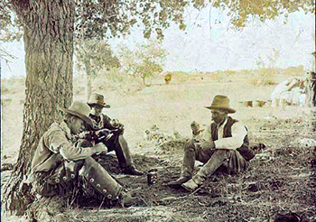
Before white colonization, the region was occupied by Karankawa Indians who exploited maritime and mainland resources on a seasonal basis as early as AD 450. Skirmishes with colonists, including the Battle of Jones Creek in 1824, resulted in expulsion of most of the Indian population to the area south of the Rio Grande by 1850.
Though the alluvial bottomlands of the county's rivers attracted settlement by Americans as early as 1820, the passengers of the schooner Lively who landed at the mouth of the Brazos in December 1821 passed on to Richmond. The area was first populated when Stephen F. Austin selected it for his proposed settlement, and eighty-nine of Austin's Old Three Hundred had grants in what is now Brazoria County by 1824.
Brazoria County became part of the Victoria district when Austin's original San Felipe district was divided in two in 1826. Brazoria Municipality was the scene of the Battle of Velasco on June 26, 1832, and witnessed other agitation against Mexican rule.
 When Stephen F. Austin declared against Santa Anna at another meeting in Brazoria on September 8, 1835, Texans began to prepare for a revolution. After the convention at San Felipe and engagements at Gonzales, Goliad, and Bexar, volunteer companies were organized and a provisional government approved on November 13, 1835. Henry Smith of Brazoria County served as the first provisional governor. Rebellion grew in 1835 and 1836, culminating in the Texas Declaration of Independence.
Citizens of the county contributed men and means to the Texas Revolution. After his capture at the battle of San Jacinto on April 21, 1836, Santa Anna and members of his army were taken to Velasco, then the location of the provisional government. Here Santa Anna signed the Treaties of Velasco with the Republic of Texas on May 14, 1836. Columbia, the seat of the ad interim government, served as the capital of the republic when sessions of the first Texas Congress met in October 1836. During the first session Stephen F. Austin died and was buried at Peach Point. Houston became the capital.
Under the provisional government, Texas accepted the constitution that made its first counties from former municipalities. Brazoria County, among the first, took its name from the Brazos River when the Congress of the republic established it on March 24, 1836. Brazoria, which became county seat when the county was organized on December 20, 1836, served until 1896, when Angleton replaced it. The establishment of Fort Bend County in 1837 and of Galveston County in 1838 drew the present county boundaries, and the towns of Columbia, Velasco, and Brazoria were incorporated by the Congress of the republic in 1837.
Yellow fever and flooding in 1843 and 1844 slowed growth, but the annexation of Texas to the United States in 1845 and the Mexican War had little effect on residents of Brazoria County, mostly farmers. During the pioneer days, the Brazos River was the chief artery by which immigration, communication, and commerce penetrated Texas from the Gulf. Small boats regularly navigated as far as East Columbia, and customhouses were located at Brazoria and Velasco.
 Residents of Brazoria County cast more than 99 percent of their votes for secession. During the Civil War Confederate blockade runners operated along the coast, and some cotton was shipped overland by mule and wagon to Mexico. Though the county suffered little physical damage in the war, the presence of federal troops and loss of profit from cotton crops in 1864 brought increasing hardship. Many plantations were divided into smaller farms or turned into pastures; others eventually became part of the Ramsey, Retrieve, Clemens, and Darrington state prison farms.
Economic recovery came slowly in the post-Civil War era. The principal crops were corn, grains, sweet and Irish potatoes, fruits, wild grapes, and cotton and sugar for export. By 1867 the value of livestock, chiefly cattle, nearly equaled that of agriculture. When cattlemen found northern markets shut off in the late 1860s, hide and tallow factories were established along the Brazos River.
Though the Galveston and Brazos Navigation Company was chartered as early as 1850, major improvements in transportation began only in the 1870s, starting with a canal across Galveston Bay, completed with the help of the federal government. By 1905 workers completed jetties to deepen the water in the harbors at Velasco and Quintana, and in part of what became the Gulf Intracoastal Waterway. By 1929 Brazos River diversion reduced the problem of sanding in the channel and opened the harbor at Freeport.
Brazoria County mineral development began at West Columbia oilfield as early as 1901. Oil production started at Brazoria in 1902, reached 12,500,000 barrels in 1921, declined during the depression, and then resumed. Brazoria County ranked fourth among Texas counties in 1946.
 An effect of World War II on the county took the form of camps for prisoners of war, which housed German soldiers and members of Rommel's Afrika Corps for a time. A second phase of industrialization began in the 1950s as "customer companies," including Monsanto and processors of chemical fertilizers, established operations nearby to make use of Dow products.
The shrimping industry grew at Freeport after World War II. In 1967, 610 boats harvested 14,000,000 pounds of shrimp; the 1971 catch was 160 times larger than that in 1970, and the harvest doubled again by 1972. Both fishing and the recreation industry, which grew up after 1960, fostered ongoing development on the Gulf Coast.
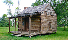
Brazoria County offers water sports, fishing, hunting, and other recreation, along with historic sites including Varner-Hogg Plantation State Historical Park. The county celebrates a San Jacinto Festival at West Columbia and the Spring Fling at Clute in April; a Mexican Fiesta at Pearland and Youth Rodeo and Frontier Days at Alvin in May; a Fishing Fiesta at Freeport, a Fireworks Display at Alvin, and the Great Texas Mosquito Festival and Parade at Clute in July; a Founders Day Celebration at Pearland in September; and a County Fair and Rodeo at Angleton and the Bluegrass and Gospel Fall Festival at Brazoria in October.
The county has a total area of 1,609 square miles, of which 1,358 square miles is land and 252 square miles (16%) is water. The population recorded in the 1850 Federal Census was 4,841. The 2010 census recorded 313,166 residents there.
Neighboring counties are Harris County (north), Galveston County (northeast), Matagorda County (southwest), Wharton County (west), and Fort Bend County (northwest). 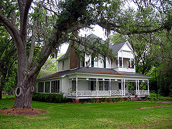
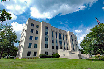
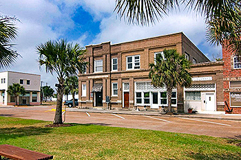
The county seat is Angleton. Other communities in the county include Alvin, Brazoria, Brookside Village, Clute, Danbury, Freeport, Lake Jackson, Liverpool, Manvel, Oyster Creek, Pearland (part), Richwood, Rosharon, Sandy Point, Surfside Beach, Sweeny, West Columbia, Holiday Lakes, Quintana, Bailey's Prairie, Bonney, Hillcrest, Iowa Colony, Jones Creek, Damon, Rosharon, Ryan Acres, Wild Peach Village, Amsterdam, Anchor, Chenango, China Grove, Chocolate Bayou, Danciger, East Columbia, English, Old Ocean, Otey, Rosharon, Snipe, Silverlake, Turtle Cove, and McBeth.
Brazoria County, Texas Records
Birth Records - The Texas Department of State Health Services has records from 1903 to present. Records for the last 75 years considered private and will only be provided to certain individuals. To obtain current information on who may obtain a record, how to submit a request and an official request form, see the Texas Department of State Health Services website or write to Texas Vital Records, Department of State Health Services, P.O. Box 12040, Austin, TX 78711-2040.
For older birth records you will have to write to the County Clerk of the applicable county. The existence of birth records prior to 1903 will vary widely from county to county. Local historical societies and genealogy collections in local libraries may be able to provide some information.
Death Records - The Texas Department of State Health Services has records from 1903 to present. Records for the last 25 years considered private and will only be provided to certain individuals. To obtain current information on who may obtain a record, how to submit a request and an official request form, see the Texas Department of State Health Services website or write to Texas Vital Records, Department of State Health Services, P.O. Box 12040, Austin, TX 78711-2040.
Marriage Records - The Texas Department of State Health Services can provide a verification letter of marriage for Texas marriages from 1966 to present. This is NOT a marriage license. To obtain a certified copy of a marriage license you must contact the County or District Clerk in the county or district where the marriage took place.
Local historical societies and genealogy collections in local libraries may be able to provide some information.
Divorce Records - The Texas Department of State Health Services can provide a verification letter of divorce for Texas divorces from 1968 to present. This is NOT a copy of the divorce decree. To obtain a certified copy of a copy of the divorce decree you must contact the County or District Clerk in the county or district where the divorce took place.
Local historical societies and genealogy collections in local libraries may be able to provide some information.