Main Menu
Scurry County Data
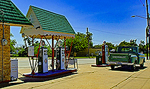
Scurry County Communities & Places
Genealogy & History Links by USGHN
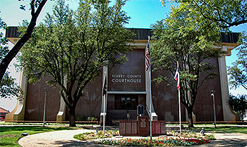
Important Scurry County Addresses
Sponsors
Scurry County Neighbors
Borden County, Texas
Fisher County, Texas Genealogy & History Network
Garza County, Texas
Howard County, Texas
Kent County, Texas
Mitchell County, Texas
Other Websites
Welcome to Scurry County Texas Genealogy & History Network!
Welcome to the Scurry County, Texas Genealogy & History Network. Our purpose is to provide visitors with free resources for genealogical and historical research. To share your genealogy or history information, send an email to txghn@outlook.com and we will happily include it here. For other Texas Counties, visit the Texas Genealogy & History Network state website and go to the appropriate county. Thanks for visiting and good luck with your research! |
|
About Scurry County, Texas...
Scurry County is at the base of the Llano Estacado in West Texas, about ninety miles northwest of Abilene. The area was named for William R. Scurry, a Confederate general. The county extends across prairie covered by bluestems, gramas, wildrye, and wheatgrasses, with mesquite trees in some sections. The county is drained by the Colorado River, which cuts across the southwestern corner of the county, and by tributaries of the Clear Fork of the Brazos River.
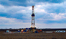
The county is one of the leading oil-producing regions in Texas, due to its location in the Permian Basin, one of the state's largest petroleum deposits. In 1982 more than 31,732,000 barrels of crude oil and over 53,088,000 thousand cubic feet of casinghead gas were produced in the county.
Indian artifacts found in the area indicate that humans have lived there since as early as 1,000 B.C. In more modern times the Apaches dominated the area until the early eighteenth century, when they were displaced by Comanches and other tribes. The Comanche war trail to Old Mexico crossed the county from 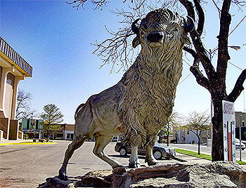 its northeast to its northwest corner. Francisco Vázquez de Coronado passed through the region in the sixteenth century. United States Army captain Randolph. B. Marcy mapped the area in 1849 during his mission to locate possible fort sites and to map a wagon trail to California. Lt. Montgomery Pike Harrison, a member of Marcy's party, was killed by Indians while exploring Bluff Creek during the expedition's return trip.
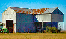
Robert E. Lee crossed through the area in 1856 while taking the field against Comanches. The Comanches were relocated to Oklahoma reservations after the Red River War of 1874–75, and buffalo hunters and ranchers moved into what is now Scurry County. Buffalo hunter J. Wright Mooar began making excursions into the region in 1874, and by 1877 Mooar was said to have killed 20,000 buffalo on the plains. That year William H. Snyder opened a trading post to sell supplies to buffalo hunters in the area, and soon a small settlement of dugouts and tents grew around Snyder's place. The first large ranch in the area was established in 1877 by Tom and Jim Nunn, who drove longhorns from South Texas to land along tributaries of the Clear Fork of the Brazos River. Ranching soon became the major industry in the area.
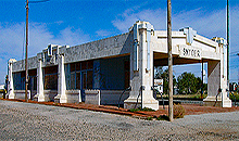
Scurry County was established by the Texas legislature in 1876 from lands formerly assigned to Bexar County. The county was attached to Mitchell County for judicial purposes until 1884, when it was 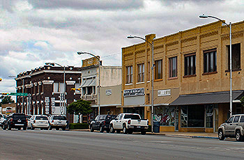 organized. Snyder, the growing trading post, became a townsite in 1882 and the county seat in 1884. A. C. Wilmeth began publishing the county's first newspaper, the Scurry County Citizen, in the 1880s. By 1890 there were 184 farms and ranches, encompassing almost 142,000 acres, in the county. The "Block 97 Controversy" kept ranchers and homesteaders aroused for years before the dispute was settled by the legislature in 1899. The controversy centered on 612,000 acres of land, mostly in Scurry County, that had been granted to the Houston and Texas Central Railroad and the Texas and Pacific Railway Company. After selling land to settlers, the railroad became insolvent. Land titles reverted to the state and homesteaders claimed land against the invalidated purchase rights of ranchers, who were eventually required to repurchase in order to hold their lands. Despite this controversy the county developed quickly during this period. By 1900 there were 586 farms and ranches in the area.
The county suffered a downturn in the 1910s, and hundreds of farmers were forced to leave their lands. Nevertheless, cotton acreage continued to expand during this period. Agriculture in the area revived during the 1920s, and the number of farms grew to 1,332 by 1925 and to 1,564 by 1930. A rapid expansion of cotton production was responsible for most of this growth. The discovery of oil in 1923 also 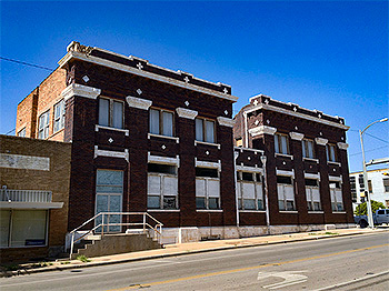 helped to stimulate the economy during this period, though production was relatively modest. The county's population growth was reversed during the Great Depression of the 1930s, which seriously hurt the local economy. Almost 198,000 acres of cropland had been harvested in 1929; fewer than 143,000 acres were harvested in 1940. Faced with federal crop restrictions, low prices, and other problems, the county's cotton farmers were most seriously affected. Cotton acreage fell by more than 50 percent during the 1930s. By 1940 the number of farms had declined to 1,446.
The county's economy was fundamentally altered during the 1940s, when new oil wells were brought into production. In 1938 only about 10,000 barrels of petroleum were produced from shallow wells in the county; by 1944 production had reached 303,000 barrels. The oil industry began to boom in 1948, however, when wells in the Canyon Reef field were drilled to 6,500 feet, and wells in the county produced over 1,112,000 barrels of oil. From 1948 to 1951 some 2,000 wells were drilled in the county, contributing to a substantial, sustained boom. While production fluctuated over the next forty years, the oil business remained an integral part of the local economy. Almost 42,583,000 barrels were produced in the county in 1956, almost 94,173,000 barrels in 1974, and about 31,732,000 barrels in 1982. By 1991, 1,825,517,000 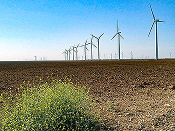 barrels of petroleum had been taken from Scurry County lands since discovery in 1923.
The county has a total area of 908 square miles, of which 905 square miles is land and 3 square miles (0.2%) is water. The population recorded in the 1880 Federal Census was 102. It peaked in 1950 at 22,779. The 2010 census recorded 16,921 residents in the county.
Neighboring counties are Kent County (north), Fisher County (east), Mitchell County (south), Borden County (west), and Garza County (northwest). The county seat is Snyder. Other communities in the county include Dunn, Fluvanna, Hermleigh, and Ira.
Scurry County, Texas Records
Birth Records - The Texas Department of State Health Services has records from 1903 to present. Records for the last 75 years considered private and will only be provided to certain individuals. To obtain current information on who may obtain a record, how to submit a request and an official request form, see the Texas Department of State Health Services website or write to Texas Vital Records, Department of State Health Services, P.O. Box 12040, Austin, TX 78711-2040.
For older birth records you will have to write to the County Clerk of the applicable county. The existence of birth records prior to 1903 will vary widely from county to county. Local historical societies and genealogy collections in local libraries may be able to provide some information.
Death Records - The Texas Department of State Health Services has records from 1903 to present. Records for the last 25 years considered private and will only be provided to certain individuals. To obtain current information on who may obtain a record, how to submit a request and an official request form, see the Texas Department of State Health Services website or write to Texas Vital Records, Department of State Health Services, P.O. Box 12040, Austin, TX 78711-2040.
Marriage Records - The Texas Department of State Health Services can provide a verification letter of marriage for Texas marriages from 1966 to present. This is NOT a marriage license. To obtain a certified copy of a marriage license you must contact the County or District Clerk in the county or district where the marriage took place.
Local historical societies and genealogy collections in local libraries may be able to provide some information.
Divorce Records - The Texas Department of State Health Services can provide a verification letter of divorce for Texas divorces from 1968 to present. This is NOT a copy of the divorce decree. To obtain a certified copy of a copy of the divorce decree you must contact the County or District Clerk in the county or district where the divorce took place.
Local historical societies and genealogy collections in local libraries may be able to provide some information.